Geoportail: The French Google Earth
Wednesday 21 April 2021
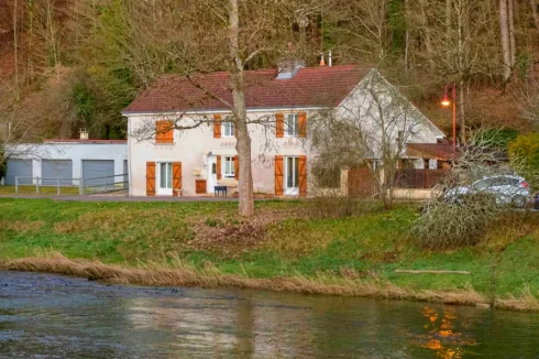
The French on-line mapping service 'Geoportail' is a worthy alternative to Google Earth for France, with great image quality and a wealth of mapping information.
Less known is the French equivalent Geoportail, despite the fact that is has been for around almost as long as the US based virtual map.
The site is provided by IGN (l’Institut national de l’information géographique et forestière), the French equivalent of Ordnance Survey, the mapping service in the UK.
Launched in 2006, it is certainly true to say that the Geoportail initial version was rudimentary and difficult to use.
However, since this time there have been several major upgrades, including the introduction of a 3D version.
Geoportail offers both aerial and satellite images of France, in much the same manner as Google Earth does for a number of countries on the planet.
The level of the elevation varies by area, but in our own comparison tests we found that in rural areas in particular the images of those provided by Geoportail were of superior quality to those in Google Earth. The images from Geoportail also appear to more recent than those from Google Earth.
Beyond this basic product, there are over 100 other cartographic overlays available, which can all be accessed through the menu button 'Données'.
The best of these has to be the lovely graphics of the detailed IGN road maps of France. Zoom on these maps and you can get to the level of an individual property.
Of possible interest to owners and buyers of French property are the land registry plots (parcelles cadastrales) on the site. The maps do not identify title plans, but if you know the plot numbers of the property you can use a measurement tool to calculate the surface land area. Another tool also enables you to measure distance.
Whilst this cadastral information is available on the official land registry site, what is useful about Geoportail is that it brings together a range of overlaying maps from various administrative departments and bodies in France to offer a single web mapping portal.
As a result, it is also possible to find a wide range of physical and other cartographical information, including agriculture, transport, energy, topography, administrative areas, culture and history, natural sites and coastal areas.
As it is open to all administrative bodies in France to add new features, you can find some maps relating to a specific theme or area, such as a map on the levels of sunshine in Provence-Alpes-Côte d’Azur.
To make best use of the features on the site, it helps to have a reasonable download speed, some patience to learn how to use it, as well as the ability to understand French, as the site is not available in the English language.
Next Article: Planning Consents Three Year Duration
Thank you for showing an interest in our News section.
Our News section is no longer being published although our catalogue of articles remains in place.
If you found our News useful, please have a look at France Insider, our subscription based News service with in-depth analysis, or our authoritative Guides to France.
If you require advice and assistance with the purchase of French property and moving to France, then take a look at the France Insider Property Clinic.